Roosevelt Island is a narrow two mile long island situated in the East River between Manhattan and Queens. Now primarily a residential island with three parks and magnificent views of both boroughs, the island has a sordid past. Originally known as Blackwell’s Island, the island was home to a number of city institutions and three hospitals. It was renamed Welfare Island in 1921. The name of Roosevelt Island was suggested by the Four Freedoms Foundation in honor of President Franklin D. Roosevelt and was renamed in 1973.
A Historical Walking Tour - Southern End
Starting at The Roosevelt Island Visitor’s Center, the walk goes south around the island through Four Freedoms Park. The walk is around four miles and almost completely flat with no steps involved. On the entire length of the walk, you have magnificent views of Manhattan, Queens, along with historical sites on Roosevelt Island. At the end of the island, Brooklyn is visible on the horizon.
The Visitor’s Center is located just to the east of the Tram Plaza. The center is run by the Roosevelt Island Historical Society; it has a number of Roosevelt Island souvenirs and books pertaining to the history of the island. A limited of snacks and beverages are also available.
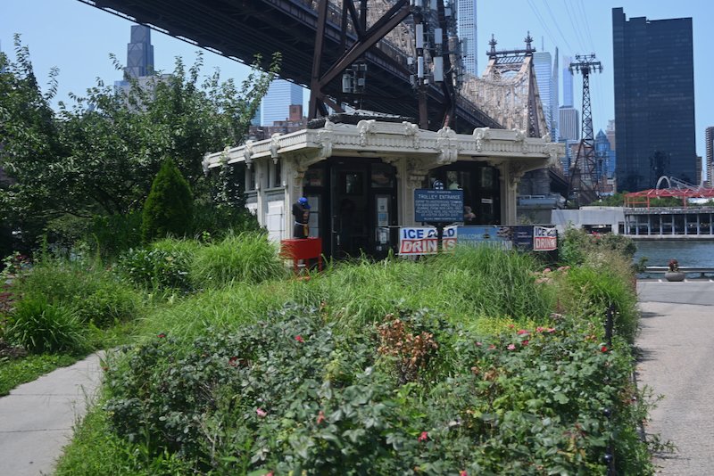
The center is housed in one of two remaining trolley entrance kiosks of the Queensboro Bridge Railway. The other kiosk is in its original location at the Manhattan entrance to the bridge on 2nd Avenue between 59th and 60th Streets. The Queensboro Bridge Railway operated a trolley line across the bridge between the Manhattan Terminal and Queensboro Plaza. The line had a stop for Roosevelt Island, then Welfare Island, halfway across the bridge.
The building that serviced the trolley stop on the bridge with an elevator to the island was located where the Roosevelt Tramway station is now. The trolley service began operating in 1909 when the Queensboro Bridge opened and was eliminated in 1957 after the Welfare Island Bridge opened in 1955 to Queens. Prior to the opening of the bridge to Queens, there was no vehicular access to the island. [credit: Joseph Brennan, Abandoned Stations, Columbia University, 2001-2002]
Once the trolley ceased operations in 1955, there was no public transportation directly to Manhattan for the next 21 years. The passenger elevator that had served the trolley was closed in 1973. The Roosevelt Island Tramway opened in 1976 as a temporary mode of transportation between the island and Manhattan until a subway line could be completed, which would take another 12 years.
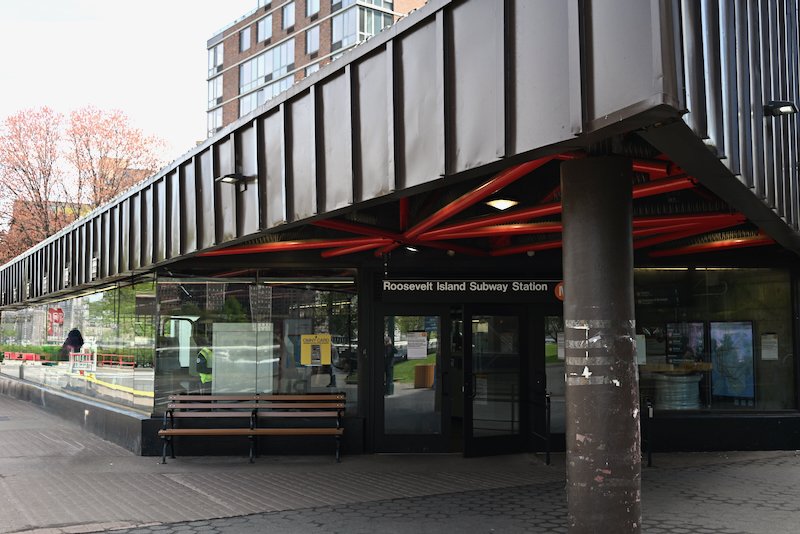
The subway station on Roosevelt Island finally opened on October 29, 1989, when the long planned 63rd Street Tunnel was completed. The tramway had proved such a success that it was kept in service after the subway began operating. It is now 50 years old, though the tram cars have been replaced and the the system has been refurbished. When the original service began, both cars operated simultaneously. Now, they operate independently of each other
The Native Americans called the island Minnahanonck, or “nice island”, using it primarily for hunting and fishing. After the Dutch first settled in the area in 1623, they purchased the island from the Native Americans in 1625 and used it for raising hogs, calling it Varckens (Hogs Island). When the British took control, it was first called Manning’s Island after Capt. John Manning, who was the sheriff of New York. It became known as Blackwell’s Island in 1685 after Manning died and his stepdaughter, wife of Robert Blackwell, inherited the island.
The City of New York purchased the island in 1828 from the Blackwell family for $32,000 with the idea of building a penitentiary there. From then until the 1950s, the city used Blackwell’s Island to build a number of institutions catering to the poor, the sick, the criminal, and the indigent. [credit: Judith Berdy, Roosevelt Island Historical Society]
Just south of the Queensboro Bridge, now called the Ed Koch Queensboro Bridge, is Cornell Tech. The 12 million square foot 12 acre campus is located on the former grounds of the Goldwater Memorial Hospital. Goldwater Hospital opened in 1939, originally as the Welfare Hospital for Chronic Disease. Goldwater Hospital was well respected for those seriously infected with polio. The hospital closed in 2013. Prior the building of Goldwater Hospital, the area was the site of the penitentiary.
Cornell Tech opened in 2017 after Cornell University and Technion-Israel Institute of Technology, two of the world’s leading institutions in the fields of science, engineering, technology, and research, were selected from 18 proposals to build a new engineering and applied sciences campus in New York City. Today, Cornell Tech offers a number of graduate programs primarily focusing on AI.
The campus consists of several buildings, including residential housing and a hotel that is currently closed. There are currently no plans for the Graduate Hotel to reopen after it closed in 2025. There is a small grassy hill just south of the campus, making for wonderful place to relax.
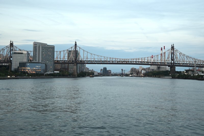
As you walk along the west side of the island, you will see a residential area of Manhattan called Sutton Place, a very wealthy neighborhood running from 59th Street to 53rd Street. The FDR drive, which parallels the East River for its entire route runs underneath a promenade for the neighborhood. Sutton Place first became fashionable in the 1920s when wealth socialites, notably Anne Morgan, daughter of J.P. Morgan, and Anne Harriman Vanderbilt, heiress of the wealthy Harriman family, built townhouses overlooking the river. Soon after that, developers started building grand co-op apartment buildings in the area.
Notable buildings on the Manhattan skyline that are visible from here are: One Vanderbilt Avenue, the JP Morgan Headquarters on Park Avenue, the MetLife Building (formerly the PanAm Building), the CitiCorp Building, the Chrysler Building, and the Empire State Building.
About a half a mile or so from the Cornell Tech campus, you will enter Southpoint Park and continue south to FDR Four Freedoms Park, passing by the ruins of the Smallpox Hospital. The remaining shell of the buildings are now a New York City Landmark. The structure forms an interesting centerpiece for both parks.
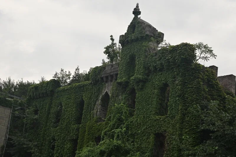
The hospital was built in 1856 and was closed in 1870. In 1902, it was reopened for the New York City School of Nursing. The two wings that are seen on either side of the turreted structure were added on when the school was opened. The school closed in 1955.
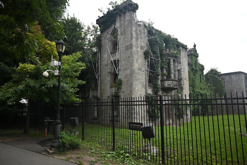
Just before the ruins in Southpoint Park is the FDR Hope Memorial. The bronze statue depicts Frank D. Roosevelt in his wheelchair greeting a little girl on crutches. As you walk up the stone path to the memorial, take note of the plaques engraved with important dates pertaining to FDR and the development of Roosevelt Island throughout it’s history.
The entrance to Four Freedoms Park is at the southern end of Southpoint Park. Four Freedoms Park was opened in 2012, though plans had been in place for the park since 1973 when Welfare Island was renamed Roosevelt Island. The original design for the park was presented by architect Louis Kahn in 1974, but funds to build it did become available until 2005. The park is built to Kahn’s specifications.
The pathway along both sides of the island is flanked in the middle by a granite hill that tapers off as it slopes down toward the tip. A set of steps leads up to the hill at the northern end. The hill is outlined by rows of trees on both sides. At the end of the hill, built directly on the southern tip of the island, is a 3,600 square foot plaza surrounded by 28 blocks of North Carolina granite. The plaza is intended to resemble a room, per Kahn’s design.
As you enter the space, you are greeted by a bust of FDR emblazoned onto a block of granite. The back of that block is engraved with the list of the four freedoms that Roosevelt presented in his Four Freedoms speech delivered to the United States Congress in 1941. The location of Four Freedoms Park is significant because FDR was influential in the founding of the United Nations in 1945. The UN headquarters, opened in 1963, are directly across the river along the Manhattan waterfront.
The small uninhabited island that you see just off the tip of Roosevelt Island is called U Thant Island, named for U Thant, a former UN Secretary General. The island was formed when blasting took place in the late 1800s to build the first subway tunnel under the river between Manhattan and Queens. Known as the Steinway Tunnel because it was originally conceived by William Steinway, owner of the Steinway piano factory in Astoria, it is now used by the 7 subway line. The island today serves as nesting ground for birds and also houses a navigational marker, maintained by the US Coast Guard.
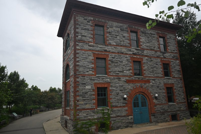
Leaving Four Freedoms Park, turn right at the end of the fence that surrounds the ruins of the smallpox hospital and follow the path directly toward the river. As you begin the walk north along the east side of the island, you will pass the Strecker Memorial Laboratory. Construction began in 1892 and it was opened in 1909 as the nation’s first center for pathological and bacteriological research.
The Strecker Memorial Laboratory was abandoned in the 1950s. It was restored by the Metropolitan Transit Authority to its original exterior condition. It now serves as a power conversion station for the E subway line that runs underneath the river and the island.
Along the east side of the island, the Queens neighborhoods of Long Island City and Astoria are visible. Now mostly residential, the area was once heavily industrial. The Pepsi Cola sign that is clearly visible from Roosevelt Island once adorned the top of of a Pepsi factory that operated in Long Island City. The factory closed in the early 1980s.
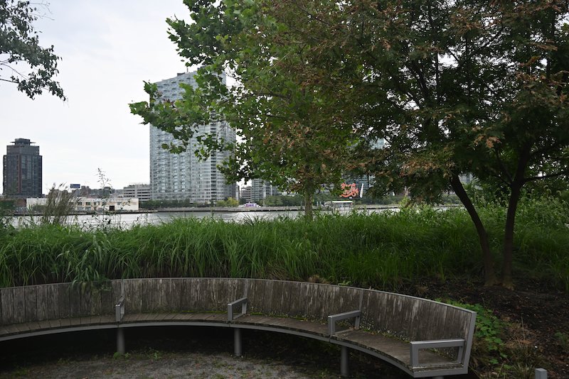
That area was also a large freight yard for the Long Island Railroad. Two of the gantries, a pier with a crane over it used to transfer railroad cars to barges, still stand along the waterfront in what is now called Gantry State Park. The gantries are both adorned with the words “Long Island”, a reminder of the industrial past and that the borough of Queens, along with Brooklyn, is actually on Long Island.
A Historical Walking Tour - The Northern End
As you begin to pass back under the Queensboro Bridge, take notice of the abandoned cinder block building on your left. This was the the Steam Plant that provided heat for some of the original buildings of Roosevelt Island, particularly Goldwater and Coler Hospitals. The plant was built in 1939 and operated until it was decommissioned in 2013. It is currently slated for demolition by the city, though there is a considerable amount of community support to preserve the building. The two smokestacks that rise alongside the bridge are some of the tallest remaining industrial structures in Manhattan.
After passing by some of the buildings of Southtown, the residential area nearest to the transportation area, Blackwell House will be on the left toward the center of the island. Blackwell House is the farmhouse that the Blackwell’s built in 1796. It is the sixth oldest farmhouse remaining in New York City. The home was used in the 1800s and early 1900s as administrative lodging for the various institutions on the island.
As the path heads north, it passes underneath several apartment buildings. This collection of buildings, now called The Landings, were among the first residences built on the island in the early 1970s and opened in 1975. The apartments are unique in that many of them are built with low counters and wide doors to accommodate those in wheelchairs, something that was not common at the time. Some of the first residents to move into them were former residents of Goldwater Hospital, which specialized in the long term care of people paralyzed from Polio.
About a mile or so north of the Queensboro Bridge, the path goes under the Roosevelt Island Bridge that connects the island to Queens. The bridge is a lift bridge built in 1955 to provide the first, and still the only, vehicular and pedestrian access to the island. It is roughly three miles to drive or walk from Roosevelt Island to Manhattan by crossing the Roosevelt Island and Queensboro Bridges.
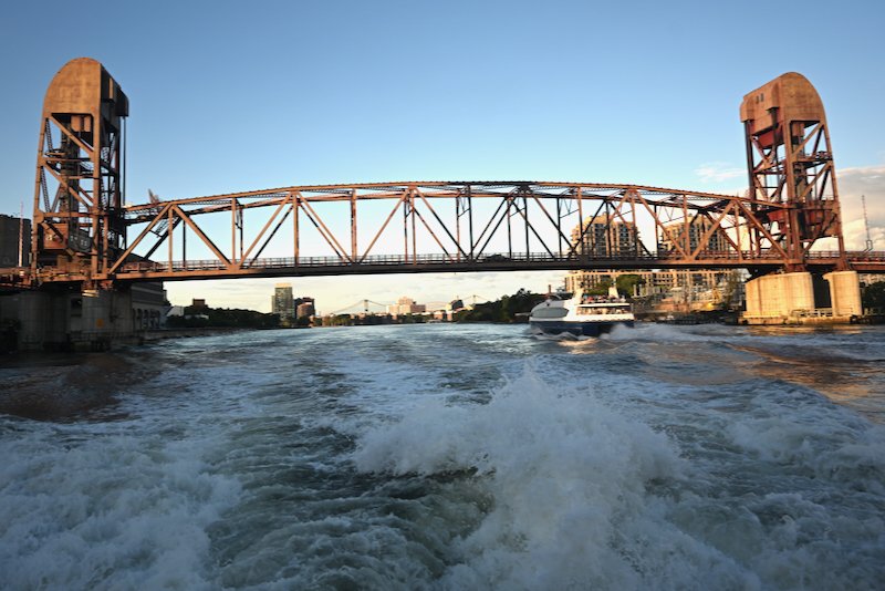
Prior to the building of the bridge, the only access to the island was by boat from Manhattan. The main ferry terminal for Blackwells Island was on 25th Street, but there was also some ferry service from 70th Street. At the end of the bridge is Motorgate Garage built in the 1960s. One of the original plans for the redevelopment of Roosevelt Island called for it to be car free.
Soon after passing the Roosevelt Island Bridge, the Octagon will be on your left. Now an apartment building, it was originally the site of the Insane Asylum. The octagonal tower from which the building gets its name is all that remains of the original building. The two wings of that form an L shape from the tower are built on much the same footprint as those of the insane asylum that housed the wards.
The Octagon tower was the administrative building with the top floor often used as an operating room. Like all the others on the island, the insane asylum was well known for its squalid conditions. In the 19th century, the city cared little about the poor and destitute, who were the primary inmates at the institutions on Blackwells Island.
Past The Octagon, is the Coler Hospital. Bird S. Coler Hospital first opened in 1952 and was eventually merged with Goldwater Hospital which had opened in 1938. Coler Hospital is now a nursing home.
At the northern end of the island is Lighthouse Park. The lighthouse that sits at the tip of the island was completed in 1872 to help ships navigate the difficult waters of Hell Gate. This part of the river is particularly treacherous because waters from the East River, the Harlem River, and Long Island sound all converge at this point. The lighthouse is 50 feet tall. It continued to operate until 1940 and was designated a New York City landmark in 1975. The park was completed in 1980.
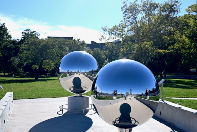
In the central portion of the park is the Nellie Bly Girl Puzzle. The series of sculptures depict various facial expressions. It is named for Nellie Bly, a pioneering investigative journalist who faked her insanity in the 1890s to document the horrendous conditions at the Insane Asylum.
From the northern end, the Queens neighborhood of Astoria is off to your right. The East River heads up to the right and the towers of the Triborough Bridge are visible just above the buildings. Randalls Island, most of which is now a city park and athletic fields, is directly ahead. The Harlem River veers off the left on its way up to the Hudson. The Harlem River separates Manhattan and The Bronx.
Heading back south, Carl Shurz Park is visible just across the river in Manhattan. The FDR drive parallels the river with the East River Esplanade that runs from Carl Shurz park to 53rd Street. Carl Shurz Park is a small neighborhood park first developed in 1910 and reconstructed in the 1930s. Gracie Mansion, the official residence of the Mayor of New York, is at the northern edge of the park.
Just after passing The Octagon again, The Sanctuary will be on your right. The Sanctuary is a private event space housed in one of the two remaining churches on the island. The church was built as a congressional space for the Insane Asylum. The pier that you pass just before The Sanctuary is where the ferries from Manhattan would dock to unload prisoners.
Not much farther south, take note of the sculptures sitting in the river. They are the Marriage of Money and Real Estate. The sculpture of three people depicting various transactions was designed by artist Tom Otterness.
The workhouse and almshouse were located along the middle section of the island as you walk south. The residential complexes of Manhattan Park and Westview sit roughly where those institutions were located. The workhouse and almshouse were built in the late 1800s to accommodate poor prisoners convicted of petty crimes, such as stealing and prostitution. Manhattan Park was built in the 1980s as the last of the originally planned residential buildings on the island.
Soon after passing by the pink apartment complex, you will see The Chapel of Good Sheperd toward the center of the island. The chapel is now used for community events. The chapel was built in 1889 by a wealthy Episcopalian and was donated upon completion to the New York City Protestant Mission. It became a place of worship for residents of The Almshouse. The building was registered as a historic landmark in 1974.
Life on the island for prisoners was grim. Food was sparse. Clothing that was provided was minimal, even in winter. The toilets were most often shared chamber pots which were emptied daily into the river. Prisoners were expected to do various chores and many of the buildings erected on the island were built by those incarcerated on Blackwell’s Island.
Getting To Roosevelt Island
The Roosevelt Island Tram runs from 59th Street and 2nd Avenue in Manhattan. It offers superb views of Manhattan and the East River as you pass over them. The trip takes around eight minutes. It is part of the MTA fare system, so you can use OMNY just as you can on the subway and busses. The tram fare is also included in the free transfer system using OMNY.
Roosevelt Island is served by the M subway line on weekdays between approximately 6am and 9:30pm. Late nights, early mornings and all day on weekends and holidays, it is served by the F or the R lines. In Manhattan, the M line goes along 6th Avenue to 57th Street before turning east to go to Roosevelt Island and Queens. The train going via Roosevelt Island from Manhattan to Queens will be signed on the side as going to Forest Hills/via 63rd street.
When coming by subway from downtown Manhattan, you will need to be on the platform signed for Uptown and Queens. When going from Roosevelt Island to Manhattan, you will need to be on the platform signed for Downtown and Brooklyn. Heading to Queens, the subway line heads out to Forest Hills.
The NYC Ferry stops at Roosevelt Island along the Astoria Route. The route operates between East 90th Street and Wall Street/Pier 11 stopping at: Astoria, Roosevelt Island, Long Island City, East 34th Street, and Brooklyn Navy Yard. The ferry dock is on the eastern side of the island just down from the tramway terminal next to the Queensboro Bridge.
To or from Queens, you can also take the Q102 which runs between Court Square and Roosevelt Island. The bus does a full loop around the island before returning to Queens. The bus stop at Court Square is directly across the street from the Court Square subway station, which is served by the 7, G, E, and F lines. The bus also stops near the Queensboro Plaza subway station, which is served by the 7, N, and W lines.
Places to Eat
Nisi, next to the Chapel of Good Sheperd, offers greek inspired American cuisine along with standard pasta dishes and sandwiches.
Cafe Aviva is a nice little coffee shop that has excellent fresh baked croissants and other pastries. It is only open until 3pm. They do seem to close for a month or so in the summer and during some holiday breaks.
At the start of Main Street is Island Rolls and Bowls. It serves some Mexican dishes and Poke Bowls. A Subway, the sandwich chain, is next door to it.
Grannie Annies Bar, in the plaza near next to the subway station, offers Irish inspired dishes as well some standard pub fare. The Irish Curry Fries are excellent - they are French fries served with a cheese sauce seasoned with curry.
The Mediterranean Eatery, about half way up Main Street in the shopping district, offers a variety of simple mediterranean inspired sandwiches and great fresh baked bread.
China 1 Kitchen, also in the main shopping district, is a decent Chinese restaurant. Be aware, though, they do not accept credit or debit cards.
In the plaza near the subway station, there are several places aside from Grannie Annies. Piccolo Trattoria offers a wide variety of dishes as well as good New York style pizza. They also serve beer and wine. Fuji East Japanese Bistro serves sushi and other Japanese dishes. Pinks Cantina advertises as serving Tacos, Nachos, and Burritos as well as soft serve and churros. At the corner of the subway plaza is a Starbucks
Grocery Stores
Three grocery stores on the island, Foodtown, Bread and Butter Market, and Wholesome Foods, offer a good selection of food. Foodtown is a good basic supermarket. Wholesome Foods has the best selection of cheeses and a variety of prepared dishes. Bread and Butter Market has a good deli counter. Any of these grocery stores have a good variety of items with which one could put together a great picnic lunch.
Summary
By the 1960s, the only institutions still operating on the island were Coler and Goldwater Hospital. The rest of the buildings were completely abandoned. Redevelopment plans began in the early 1970s. Today, Roosevelt Island is primarily a residential community offering a combination of affordable housing, well priced rental apartments, and co-ops. There is a school, a branch of the New York Public library, several shops, an indoor sports arena, and several playing fields.
The island is a wonderful place for a walk, offering unparalleled views of the East River, Manhattan, and Queens with Brooklyn in the distance. There are numerous places to take a break and enjoy the gentle breeze that continuously blows off the river and down from Long Island Sound. The sound of the water lapping against the shore adds to the melancholy of the place. Several parks and grassy patches are a great place to picnic while enjoying a bit of quiet from the sounds of the city.
